

The city of Vijayanagara was founded in 1336 AD on theTungabhadra River, about 120 Km west of Bellary near Mysore in Karnataka, South India.

As capital of a successful kingdom, the city flourished, dominating the political and cultural milieu of South India for 229 years.
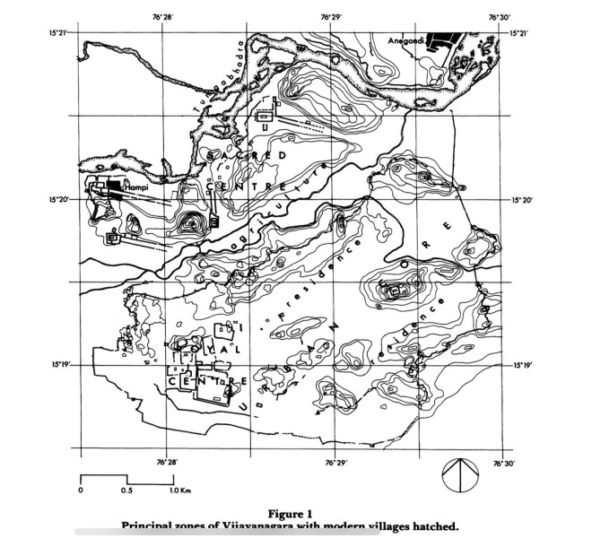
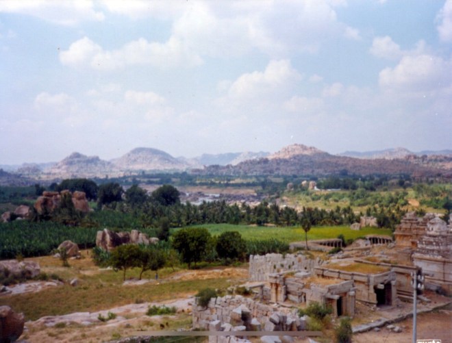
The urban settlement of Vijayanagara covers an area of around 26 Km and is bound on the north by the Tungabhadra River and on the south by the Sandur hills, which are composed of two parallel ranges running southeast – northwest. The area between the two ranges is known as the ‘Valley of Sandur’. In the north of the site, a valley running southwest to northeast, and representing an earlier course of the Tungabhadra, cuts the settlement into two separate and geographically distinct zones. An artificial irrigation canal, the Turtha Kalure, flows along the southern side of the valley. The zone to the north of the valley is characterized by a rocky and uneven landscape, whereas the southern zone is situated in a large plain, broken by occasional outcrops of igneous granite.
General Layout of the City
The Sacred Centre
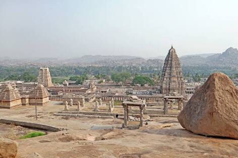
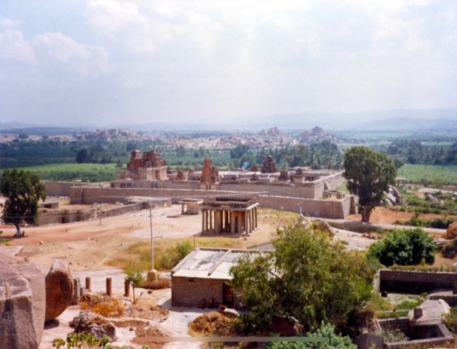
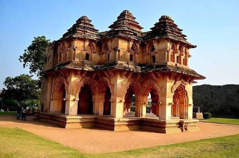
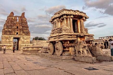
The rocky zone to the north of the valley is traditionally imbued with ritual and mythical importance and contains numerous temples and shrines. Four temple complexes, the Virupaksa, Balkrishna, Achyut Raya and Vitthala are situated in prominent positions. This zone has been identified as the ‘sacred centre’.
The Urban Core
In the north, beyond the two parallel ridges, is the Urban Core of the city. This area incorporates the residential areas as well as a complex of enclosures which comprises the ‘royal centre’. This is clearly demarcated by a complete ring of massive fortifications having strongly defended gateways. This wall is in the shape of an elliptical area follows the granite outcrop of the site and is around 4 Km along its northeast-southwest axis. This area contained the bulk of the population.
Innumerable rubble remains and dense pottery fragments indicate extensive habitation. In between are interspersed Hindu and Jain temples and shrines, as well as a mosque and a cemetery in the Islamic quarter.

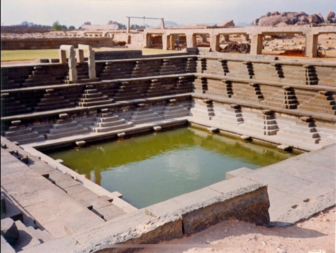
The alignment of structures and gateways indicate a radial system of roads with the main routes converging on the Royal centre. Rows of shops line the main streets. This zone is located at the southwestern end of the Urban Core, and is surrounded with another set of fortification wall, fragments of which can still be seen. The structures in this area include the remains of ceremonial, military and residential buildings, as well as an elaborate hydraulic system for conducting and storing water.
The Royal Centre
This Royal Centre is divided by high walls into a number of irregularly shaped and tightly interlocking enclosures which are entered through elaborate gateways and small doorways.
Beyond the Urban Core to the south and west, in the plain, are the outlying quarters of the capital, the remains of which are now incorporated into modern villages and towns such as Kamalapuram, Malpannagudi, Kadirampuram and Hospet.
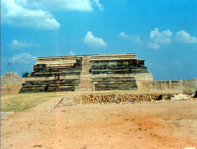
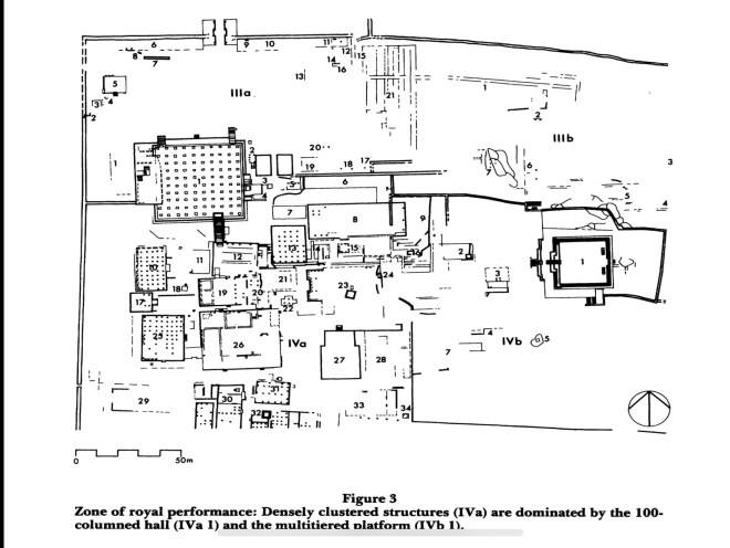
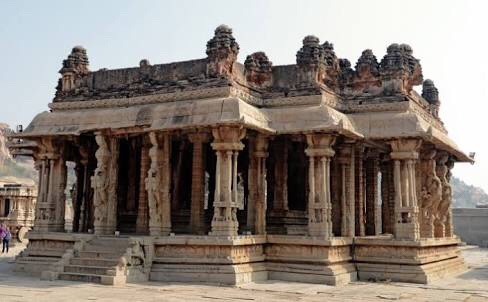
The excavations by Nagaraja Rao in 1983 and 1985 in the Royal Centre provide important evidence for courtly ceremonial and residential buildings. The plans of the excavated remains can be divided into two groups: In the first category are platforms with square and rectangular floor areas entirely divided into aisles by columns. The finest example of this type are at Enclosure IV where also is situated the multi-storeyed Mahanavmi platform.

In the second category are the palaces, the most characteristic feature of which is the symmetrical plans and the ascending sequences of floor levels which are arranged in U-shaped fashion around three sides of an open courtyard.
Portions of a sort of water supply and drainage system have also been unearthed.
Cosmic City
In the words of John Fritz, Vijayanagara was a ‘cosmic city’. The concept was first propounded by P. Wheatley in 1979 and re-iterated by J.F. Meyer for Peking. According to this concept, the city was sacred when it reproduces in material form a pattern that exists in cosmic realm. The cosmic cities, thus, are characterised by three features:
(a) orientation, as aligned with cosmos;
(b) symbolism of centrality; and
(c) the throne of the sacred king.
We know that typical ‘Hindu’ cities were aligned according to cosmic patterns, the mandala defined and as laid down by the sacred texts, the sastras. Fritz tries to argue that even though the overall plan of the Vijayanagara does not appear to ‘conform to a shastric urban mandala’ [Fritz, “Is Vijaynagara a Cosmic city?”, Vijayanagara: City and Empire, ed. S. Dallapiccola & S. Zingel-Ave Lallement, Heidelberg, 1985], certain aspects of the layout may be in concordance with theoretical prescriptions.
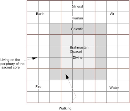
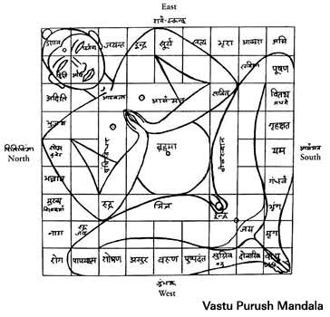
According to one of these prescriptions, the fortified capital was to consist of nine by nine squares, in the middle of which was the temple housing the king’s deity. The residence of the king was to be located to the west of this temple, while the audience hall and throne was to be to the east. Surveys by Fritz, Michell and Nagararajarao have shown the relation of the Ramachandra Temple and the royal areas was similar and conforms to this model.
The zone of Royal residence within the Royal centre had complex entries leading to large palaces surrounded by open courtyards and other structures. The palaces themselves were quite formal in layout and comprised of raised basements with U-shaped plans.
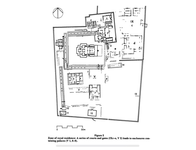
The zone of Royal Performance comprised of larger and more direct entries leading to large courts which faced the large ‘public’ buildings and the Mahanavmi Pavilion: it is a multi-tiered stone basement in the highest point in the royal centre.
The Ramchandra Temple does not only stand at a point which separate the “inner” (or the private) from the “outer” (the public), but is also axially and visually aligned with the hills to the north and northeast.
All routes are directed towards or circulate around the royal centre, and within it, it passes through the open space where the temple is built. Thus movement inward is directed to the seat of king’s activity, and within this, to the temple of god. As they lead through the walls of the royal centre and approach the temple, the principal roads of the city (from the northeast and east) become sacred ways, lined with shrines. The royal centre and the temple also become the place of origin of roads leading outwards into the rest of the city and empire beyond.
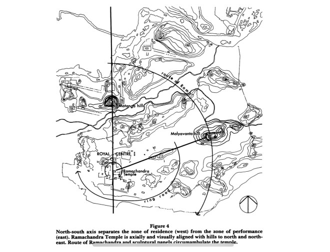
It has also been shown that the movement within the capital circumambulated the royal centre in a clock-wise direction (as in the case of pradakshina). On a larger scale, a sequence of ring roads passed around the royal centre, linking residential areas of the urban core (east) to temples in the western half of the sacred centre.
Thus all these urban elements tried to link the terrestrial realm of the king with the celestial realm of the god. The paln of the royal centre together with the roads of the city, its walls and gates, its tanks and aquaducts, its temples and its rituals all embody the cosmic order. Both king and god were the focus of the city.
• Syed Ali Nadeem Rezavi

The urban settlement of Vijayanagara covers an area of around 26 Km and is bound on the north by the Tungabhadra River and on the south by the Sandur hills, which are composed of two parallel ranges running southeast-northwest.
Sir, is it northeast-southwest or southeast-northwest?
Overlooking the south bank of the river – which flows here in a northeasterly direction – is a ridge with several rocky hills (such as Hemakuta and Matanga). This ridge, together with another that runs parallel to it further south, defines a valley open at either end.
(John m. Fritz and George Michell, ‘Interpreting the Plan of a Medieval Hindu Capital, Vijayanagara’, World Archaeology, Vol. 19, No. 1, Urbanization (Jun., 1987), p. 108
LikeLike